Share Saint Paul Bicycle Plan on FacebookShare Saint Paul Bicycle Plan on TwitterShare Saint Paul Bicycle Plan on LinkedinEmail Saint Paul Bicycle Plan link
The City of Saint Paul is updating the City's Bicycle Plan. Thanks to everyone that provided feedback on the proposed network and the drafted priorities.
Bicycle Plan Network Map
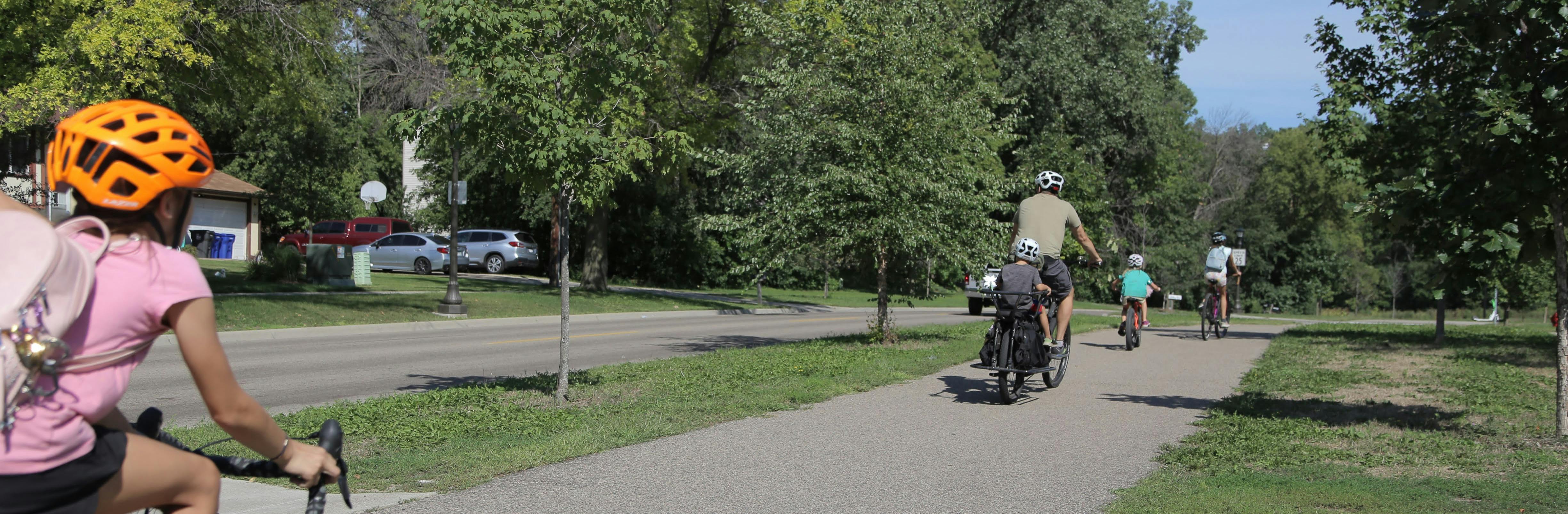
The planned bicycle network shows where the City plans to build bikeways in the future. You can view comments that were added to the map. The colored lines show different spaces for biking called "bikeways".
Shared lanes are streets where people biking and driving share the street.
Bicycle boulevards are streets where people biking and driving share the street. The City might consider limiting driver access on these streets or adding physical elements to the street that would encourage slower driving and limit traffic. (existing examples on Charles Ave, Margaret St)
Striped bike lanes are where white lines striped on the pavement next to cars provide a separate "lane" for people biking. (existing examples on Summit Ave, Arlington Ave, Ruth St, Raymond Ave, Cesar Chavez St)
Separated bikeways and paths are streets where the space for biking is physically separated from drivers using a curb, a boulevard, etc. (existing examples on Como near Fairgrounds, Mississippi River Blvd, Johnson Pkwy, Wheelock Pkwy, Wabasha and Jackson St downtown, Robert Piram Trail on Plato)
Policy and process priorities are things the City should do to expand the bike network and make biking easier. Check out the planning document to learn more about priorities and how they were decided. The draft policy and process priorities are:
When the City is choosing streets for reconstruction, the planned bicycle network should be considered
Plans and funds for maintenance of the bike network (i.e., snow clearing, striping, filling potholes, replacing flexible plastic posts)
Pursue external funding to implement the bicycle network, and conduct preliminary analyses to be more competitive for the external funding
Coordinate with local partners and railroad companies to construct regional bikeways in rail corridors
Next Steps
City staff will review all the feedback received through the interactive map, survey, meetings, community events, emails, phone calls, and conversations and use it to create a final draft of the Bicycle Plan.
The final Bicycle Plan will go to the City Council for a public hearing and adoption towards the end of 2023. There will be an opportunity to submit feedback on the final plan as part of the public hearing process, and before formal adoption.
Once the updated plan is adopted, city planners and engineers will use the updated Bicycle Plan to make decisions about the design of streets in Saint Paul.
Stay involved in the Bicycle Planning Process
To learn much more about the Bicycle Plan, please visit: stpaul.gov/bikeplan.
Thank you for taking the time to share you thoughts.
The City of Saint Paul is updating the City's Bicycle Plan. Thanks to everyone that provided feedback on the proposed network and the drafted priorities.
Bicycle Plan Network Map
The planned bicycle network shows where the City plans to build bikeways in the future. You can view comments that were added to the map. The colored lines show different spaces for biking called "bikeways".
Shared lanes are streets where people biking and driving share the street.
Bicycle boulevards are streets where people biking and driving share the street. The City might consider limiting driver access on these streets or adding physical elements to the street that would encourage slower driving and limit traffic. (existing examples on Charles Ave, Margaret St)
Striped bike lanes are where white lines striped on the pavement next to cars provide a separate "lane" for people biking. (existing examples on Summit Ave, Arlington Ave, Ruth St, Raymond Ave, Cesar Chavez St)
Separated bikeways and paths are streets where the space for biking is physically separated from drivers using a curb, a boulevard, etc. (existing examples on Como near Fairgrounds, Mississippi River Blvd, Johnson Pkwy, Wheelock Pkwy, Wabasha and Jackson St downtown, Robert Piram Trail on Plato)
Policy and process priorities are things the City should do to expand the bike network and make biking easier. Check out the planning document to learn more about priorities and how they were decided. The draft policy and process priorities are:
When the City is choosing streets for reconstruction, the planned bicycle network should be considered
Plans and funds for maintenance of the bike network (i.e., snow clearing, striping, filling potholes, replacing flexible plastic posts)
Pursue external funding to implement the bicycle network, and conduct preliminary analyses to be more competitive for the external funding
Coordinate with local partners and railroad companies to construct regional bikeways in rail corridors
Next Steps
City staff will review all the feedback received through the interactive map, survey, meetings, community events, emails, phone calls, and conversations and use it to create a final draft of the Bicycle Plan.
The final Bicycle Plan will go to the City Council for a public hearing and adoption towards the end of 2023. There will be an opportunity to submit feedback on the final plan as part of the public hearing process, and before formal adoption.
Once the updated plan is adopted, city planners and engineers will use the updated Bicycle Plan to make decisions about the design of streets in Saint Paul.
Stay involved in the Bicycle Planning Process
To learn much more about the Bicycle Plan, please visit: stpaul.gov/bikeplan.
Thank you for taking the time to share you thoughts.
Thank you for your interest in biking in Saint Paul. The survey is now closed as staff are reviewing the responses to use in creating a final draft of the Bicycle Plan.
Check out the Planning Document for more details
The planned bike network is discussed on page 52 of the Draft Bicycle Plan. Network priorities (discussed on page 86 of the document) are where the city plans to build bikeways in the short term.
Share Draft Bicycle Plan survey (now CLOSED) on FacebookShare Draft Bicycle Plan survey (now CLOSED) on TwitterShare Draft Bicycle Plan survey (now CLOSED) on LinkedinEmail Draft Bicycle Plan survey (now CLOSED) link